Quetta City: The orchard of Pakistan: Quetta is the fifth largest city in Pakistan. It is also called the orchard
of Pakistan because of its flora and fauna.
Quetta has an average elevation of 1680 meters (5500 feet) above sea level which makes it not only the largest city
in Pakistan but also a city above sea level.
Its population is between 896090 and 2.8 million which makes it the sixth-largest city in Pakistan.
Quetta is a hub of trade and communication between the two countries due to its proximity to the Durand Line,
which borders Afghanistan in northeastern Balochistan. The town is located on the Bolan Pass road.
It was the only way to get to and from South Asia.
Quetta City: The orchard of Pakistan
Quetta city
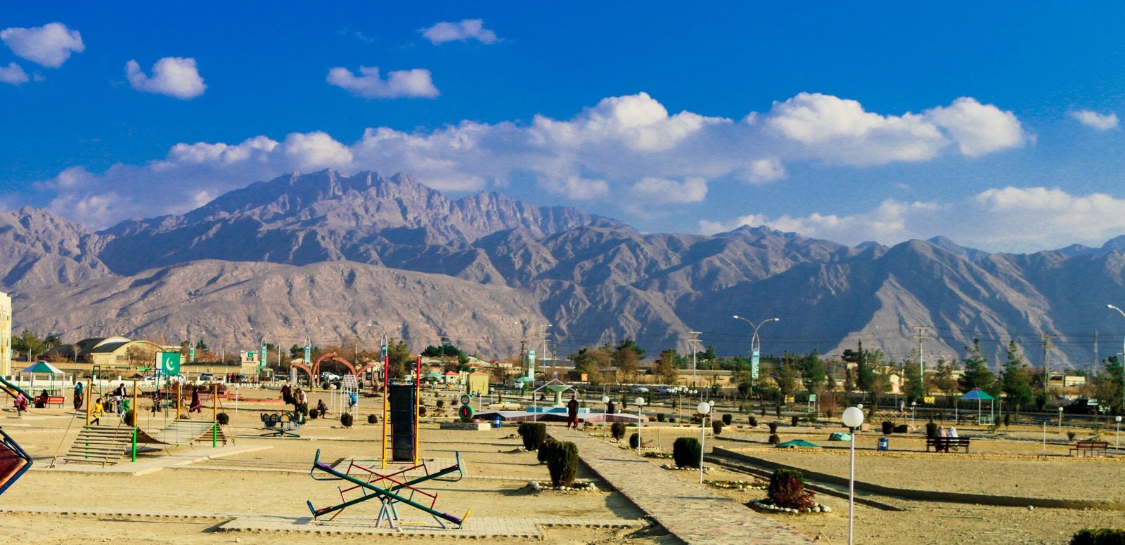
The city of Quetta is also spelled “Kawata” which is a Pashto word meaning fort.
It is believed that the city got its name from its four mountain ranges (Chiltan, Takto, Zarghoon, and Murder)
which formed a decision around it.
Quetta was first mentioned in the eleventh century when Sultan Mahmud of Ghazni invaded South Asia.
The Mughal emperor Humayun stayed in Quetta on his return from defeat in Iran in 1543, leaving behind his
one-year-old son Akbar. Until he returned two years later.
In 1709 the area came under the rule of Hotaki and in 1747 it was annexed by Ahmad Shah Durrani to the Durrani Empire.
In 1828, the first Westerner visited Quetta and stated that there was an earthen fortified fort. Around which there
were three hundred mud houses.
The Muslim population supported the Muslim League and Tehreek-e-Pakistan. Quetta was made the capital of the
newly created province of Balochistan.
Before the other Baloch kingdoms met, including Kalat, Makran, Lasbela, and Kharan.
Until the end of Ayub Khan’s system of provinces, Quetta remained the capital of the province till 1959. After
the restoration of the provincial system, Quetta was again made the capital of Balochistan.
Geography:
Quetta
It covers an area of 2653 sq km (1024 sq mi) and consists of a series of valleys that give it the appearance of a
a natural fortress called Chiltan, Takto-Murder, and Zarghoon.
Quetta and its adjoining districts Dera Ismail Khan in the northeast. Sibi and Dera Ghazi Khan in the east,
Sukkur, and Jacobabad in the southeast, Karachi and Gwadar in the south, and Ziarat in the northeast.
The nearest largest city is Kandahar in Afghanistan, west of Quetta.
Climate
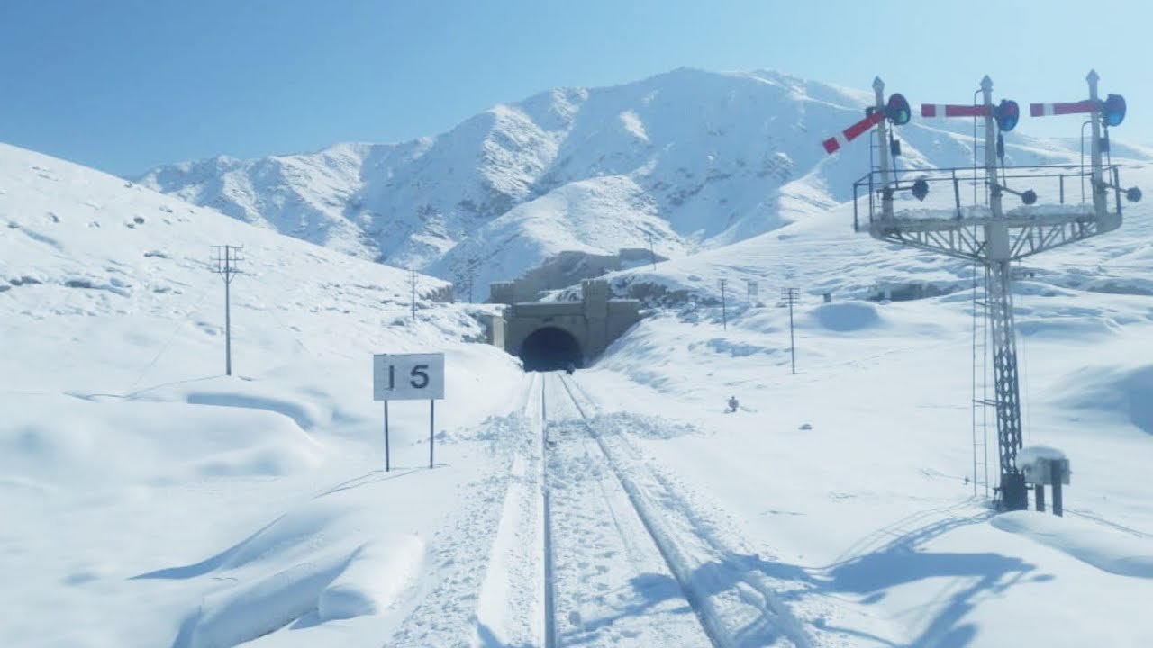
The climate of Quetta is semi-hot and dry due to which there is a big difference between summer and winter
temperatures.
Summers begin in late May and last until early September, with average temperatures of 24 to 26 degrees
Celsius or 78-75 degrees Fahrenheit.
Quetta has a maximum temperature of 420C or 1080F which was recorded on July 10, 1998. Autumn starts
in late September and lasts till mid-November with an average temperature of 18-12 degrees Celsius or (55). -650 F).
Winters begin in late November and last until the end of March, with average temperatures hovering around 4-50 C (39-410F).
Quetta City at Night
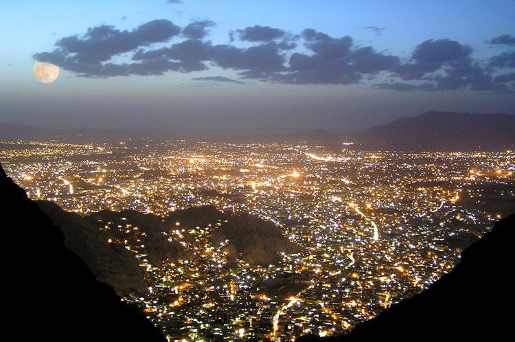
Quetta has the lowest temperature of -18.30C (-0.90 F) which was recorded on January 8, 1970.
Spring begins in April and lasts until the end of May, with an average temperature of around 150C (600F).
Unlike the eastern parts of Pakistan, Quetta does not receive much rainfall during the monsoon. In winter, snowfall
occurs in December, January, and February. It is a source of irrigation.
The city experienced a severe drought from 1999 to 2001. During the drought, the city did not receive any snowfall
and the rainfall was below average.
The city was hit by snow in 2003 after a five-year hiatus.
The city received normal rainfall and snowfall in 2004 and 2005.
The city received no snowfall in 2006, 2007, and 2009, and on January 29, 2008, the city received four inches
of snow in four hours.
On February 2, 2008, the city received the heaviest snowfall in 10 years, with ten inches of snow falling in ten hours.
In the winter of 2010, Pakistan received below-average rainfall due to El Niینوo.
Government and politics
Under the administrative review of Pakistan which took place in 2001.
Quetta was transformed into a city district and divided into two towns, including several union councils.
Transporting
Quetta Railway Station is one of the tallest railway stations in Pakistan with an elevation of 1676 meters or
5495 feet above sea level.
This railway line was laid during British rule in 1890 to connect Quetta with other parts of the country.
The railway system connects Quetta to Karachi in the south with a length of 863 km (536 miles).
Lahore (1170 km or 727 miles) in the northeast and Peshawar (1587 km or 986 miles) in the northeast.
Along with the railway, there is also a road that connects Quetta to Karachi via Sibi, Jacobabad, and Rohri.
Quetta is connected to the whole country by road. One road connects it with Mastung, Kalat, Khuzdar, and Lasbela Karachi.
The remaining major roads from Quetta to Karachi, are via Sibi.
Jacobabad, Sukkur, and Hyderabad, and two roads from Quetta to Lahore one (old) via Sibi, Jacobabad, Sukkur, Rahim Yar Khan,
Bahawalpur, and Multan, and the other via Khanozai, Muslim Bagh, Loralai, Fort Mandro, Dera Ghazi Khan and Multan. Are
Quetta is connected to Afghanistan by Chaman and Iran is connected to Mastung, Noshki, Dalbandin, and Taftan.
Educational institutions
There are many institutions of higher learning in Quetta.
Islamia schools which Quaid-e-Azam called Chhota Aligarh.
Federal Government Degree College (FG)
Reconstruction Public College
From the Military Command and Staff College, which was established by the British in 1905.
Its centenary celebrations are celebrated in 2005.
The University of Balochistan was established in 1974.
Balochistan University of Information Technology, Engineering, and
Management Sciences (BUITEMS)
Sardar Bahadur Khan Women’s University
Bolan Medical College
Institute of Agriculture
Geological Survey of Pakistan
Animals and plants
Dairy animals such as markhor (wild sheep) are found in the Quetta area.
Local birds such as partridges, warblers, blue rock pigeons, golden eagles, birds, hawks, hawks,
and bearded vultures are found.
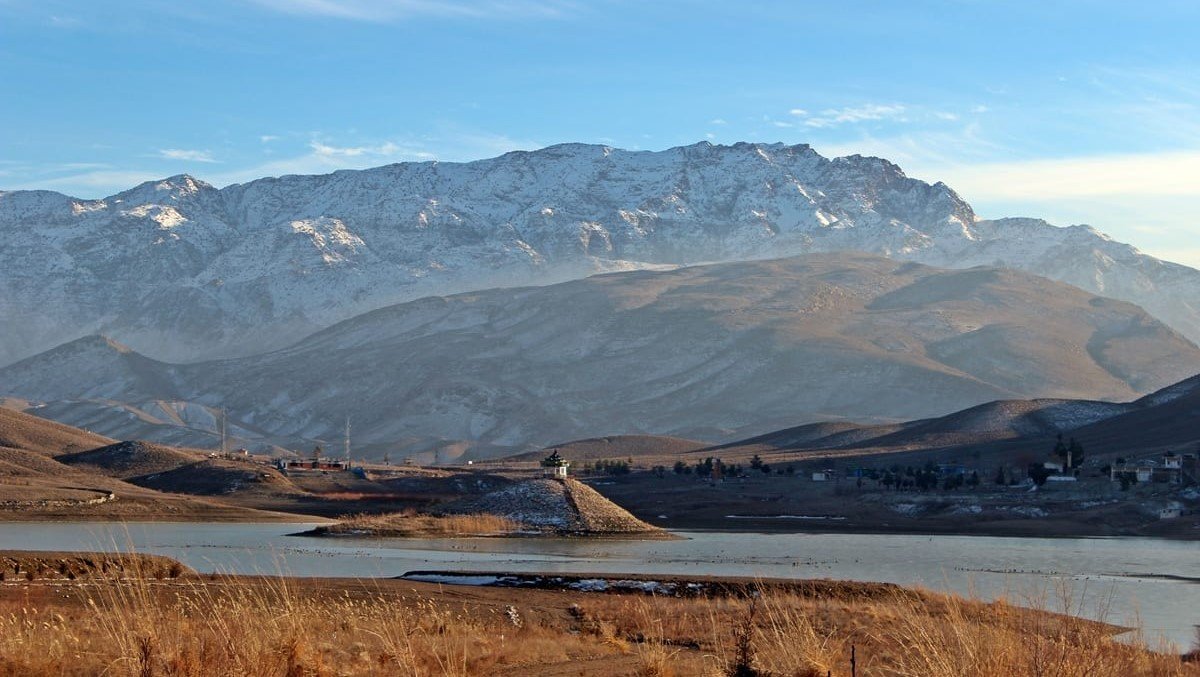
Hanna Lake Quetta
A total of 225 species of plants are present in the area, including pistachios, junipers, wild olives, and
wildish, and wild almonds.
Also found are wild figs, burberries, wild cherries, bees, and wild shrubs such as Aphrodite antimalalia
and Guardia.
Lake Hannah is located between the mountains, like a turquoise body, 10 km (6 miles) east of the city.
It is an attractive place with boat rental facilities and has an irrigation dam on one side.
To its east is the Hayat Durrani Sports Academy, the only water sports training center in Balochistan.
Hazar Ganji Chiltan National Park is 20 km northwest of Quetta.
The park is a protected area for Markhor. The name of the park “Hazar Ganji” means “Thousands of Treasures”
which is spread over 32,500 acres or (132 sq km).
It has an elevation of 2221 to 3264 meters or (5625 to 10700 feet).
According to the elders, there are thousands of buried treasures in the middle of these mountains which were
buried by various forces such as Sukuti, Bactrian, Muslims, and Mongols.
On Monday, there is a waterfall in the historic Bolan Pass, 70 km from Quetta city.
Karkhasa is a narrow valley 10 km (6.2 miles) west of Quetta, in which thousands of species of plants and
animals are found.
Chilton Hill Park offers a breathtaking view of the city, a popular tourist destination for tourists.
The Arziani Museum on Sariab Road in Quetta is a collection of rocks and caves in Balochistan.
Command and Staff College
The museum is a historical museum of the British Army.
It is located in the bungalow of Field Marshal Bernard Montgomery.
The Quetta Historical Museum houses old guns, swords, artifacts and Stone Age tools, old pottery,
and artifacts from Mehrgarh.
Pictures from before the 1935 earthquake, and rustic coins, are also available.
The Balochistan Arts Council Library houses all the arts and crafts of Balochistan province.
The population of the city increased from eleven thousand in 1891 to now between 1865137
and 1 207694 and according to a 2012 report, it is the sixth-largest city in Pakistan.
Quetta festivals and shopping
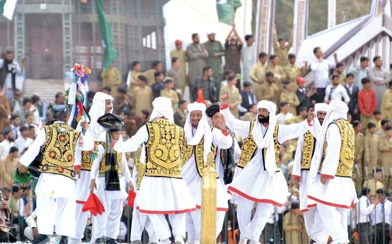
Cultural and religious festivals are held in Quetta every year.
The two Eids are celebrated at the end of fasting and at the end of Hajj, in which Muslims celebrate music,
distribute sweets, and give gifts to each other.
Buzkashi is a festival of Pathans, in which two teams sit on the backs of horses and try to snatch
a goat from each other.
Quetta Bazaar consists of Shara Liaqat (Liaqat Bazaar, Surajganj Bazaar) Shara Iqbal (Kandahari Bazaar),
and Jinnah Road, colorful handicrafts are sold.
In particular, Balochi glasswork and Pashtun handicrafts, Afghan carpets, fur coats, embroidered jackets, vests,
coats and other traditional Pashtun items are sold.
Pashtun and Baloch carpets are made by the tribes of the area. They are usually not very expensive and good
, like carpets from Turkey or Iran but more durable.
From carpets that imitate Iranian and Turkish carpets and are available in major cities of Pakistan.
Quetta Food
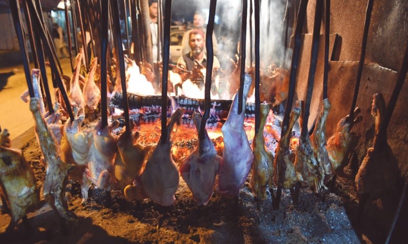
Traditional Pashtun cuisine includes khadi kebabs and sheep carrots, Balochi Saji, and other traditional
dishes available in the city.
The traditional dish of the Pashtun tribe is “Rosh” which non-natives call “Namkeen”. It is served in hotels
in and outside the city.
The best-minced meat in the country is raised in the areas around Quetta and then served in these hotels.
Another Pashtun dish is “Landhi” which is taught to the whole goat in winter and kept fresh. Khadi Kebab
is a goat’s barbecue. Saji (goat’s thigh) and “Palau” are local dishes.
Shaheed Nowruz Stadium is the largest stadium in the city. Ayub National Stadium in the
city is used for many purposes like football and cricket.

